
 For EMS, flight crews & dispatch
Local knowledge.
Ready when you need it.
Emergency Care Infrastructure. Find hospital capabilities, facility contacts, helipad details, and location information in one professional field reference.
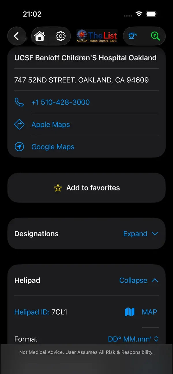
The expected—and the harder to find.
Core emergency care
Trauma, stroke, cardiac, burn, pediatric, and neonatal capabilities, organized for a practical field reference.
Specialized resources
Species-specific antivenom, hyperbaric chambers, ECMO, Impella, intra-aortic balloon pumps (IABP), and high-risk obstetric care.
Location & access
Facility contacts, helipad information, navigation links, and coordinates. Search by location, proximity, or designation.
Emergency veterinary facilities
Find listed emergency veterinary resources alongside the hospital directory.
Listed capabilities vary by facility and region. Confirm current availability directly and follow local protocols.
Coordinates that work with your crew.
| 5 coordinate formats | DD.dddddd° DD° MM.mm′ DD° MM′ SS″ UTM MGRS/USNG |
|---|---|
| Helipad identifiers | FAA or custom identifiers alongside location coordinates |
| 3 datums | WGS 84 · NAD 83 · NAD 27 |
| 3 distance units | Miles · Kilometers · Nautical miles |
Convert on device. No internet needed.
Coordinate, datum, and distance-unit conversions happen directly on your device.
From unfamiliar territory to a usable field reference.
Search the area you are covering, open a facility to inspect the details relevant to your crew, and download the region before you need it offline.
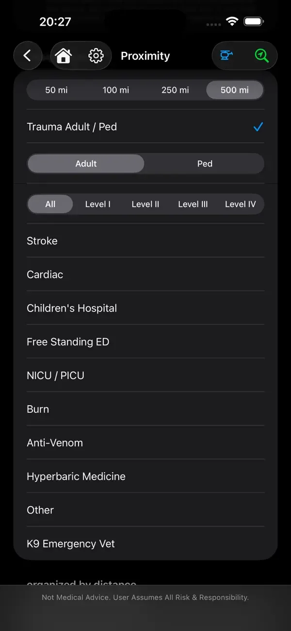
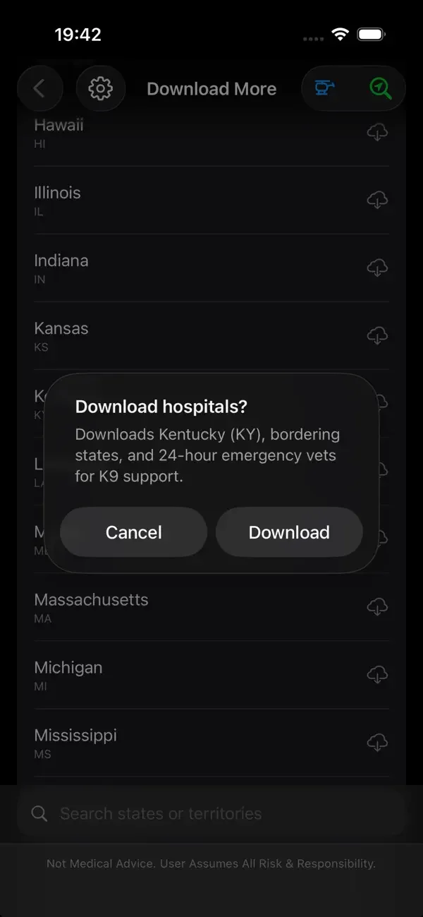
Screens from our published iOS listing. Appearance and features vary by version and platform.
Prepare once. Carry the reference.
Choose your region.
Check the coverage and facility details relevant to your trip or deployment.
Download before departure.
Use a reliable connection and confirm the relevant data is available on your device.
Access it offline.
Keep downloaded facility information at hand. External navigation may still require a connection.
This app should be on every medic’s phone. We got auto launched for a mutual aid mva, but the patient ended up having only minor injuries. turns out he was having a massive stroke. unsure of the area, we didn’t know where to go. This app took the stress of finding the right hospital and even gave our pilot the helipad identifier. it’s a real game changer.
Flight Medic — Steve W
Before you head out.
What works without internet?
Downloaded TheList facility information and on-device coordinate, datum, and distance conversions. Download the relevant data before departure. External navigation and other services may need a connection.
Does regional coverage include every facility?
No. Regional completion describes indexing progress. Facility details, services, and designations vary. Confirm current facility information and follow local protocols.
How do I prepare a region for offline use?
Open TheList on a reliable connection, select the area you need, and download its facility information before departure. Check that the download is available on your device before relying on it without service.
What if a facility detail is outdated or missing?
Please send the facility name, location, the detail to review, and a source if you have one through our contact page. See Data & Coverage for how to interpret the directory.
Are iOS and Android screens identical?
TheList is available on both platforms. Appearance and features can vary by platform and app version; check your app store listing for the current release.

TheList
MaydaySOS
For travelers & everyday life
Emergency help, made simpler. A consumer-focused product designed to help people find emergency care away from familiar places.